
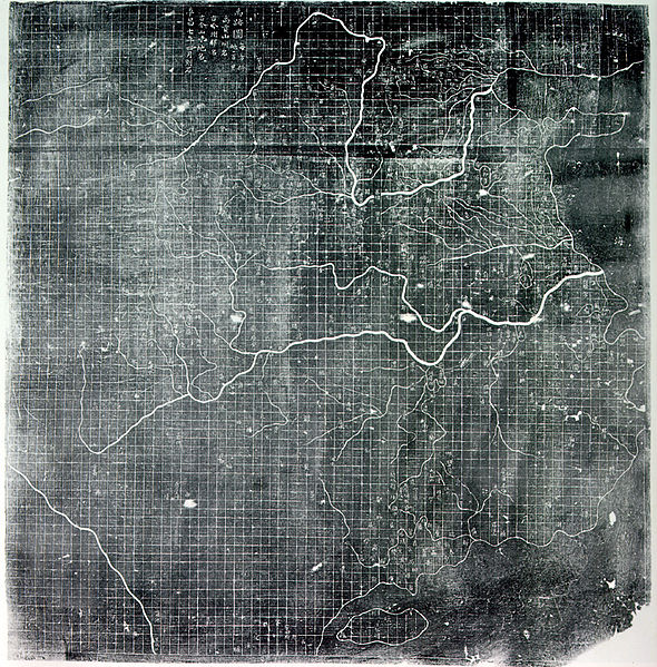
It’s amazing how precise the map is, with what looks like a coordinates projection grid, specially comparing the map with the kind europeans were making at the time.
The graduated scale of this gridded map is at 100 li (Chinese mile) squared for every representative square in the grid. The overall size of the map is 3 ft squared. The coastal outline is relatively firm and the precision of the network of river systems is incredibly accurate. The name of the geographers and cartographers who initially created the map are unknown. In the year 1142 a copy of the map was preserved at Zhenjiang in Jiangsu province by a certain Yu Chi, who was then a Prefectural Director of Studies. There is also mention of an earlier copy of about 1100 AD which itself was based on the Chang’an version. Needham asserts that the map was used primarily to instruct students while referring to sites described in the ancient Yu Gongchapter of the Classic of History.